💡 About
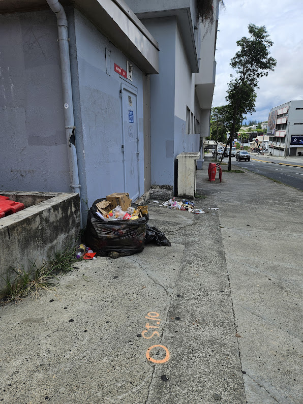
Recently I saw a pile of garbage on the sidewalk next to a street I'm living in:
Generally (it was not the first time), I apply the following process:
- 📸 Take a photo
- 📝 Send a mail in which I explain what's wrong
... but this time I wondered if one could automate a kind of "sidewalk cleanup status reporting", I mean like a batch process.
This is what triggered this reflection and pitch with the following stack:
-
ollama: from cli, on my personal workstation (core i5/8 Go RAM) -
bakllava, a "multimodal model consisting of theMistral 7Bbase model augmented with the LLaVA architecture."
I initially got two main ideas (but they have a wide range of customizations.
ℹ️ Notice that I have designed the thing so the terminal that shoots photos does not require a lot of power, but rather rely on a remote asynchronous analysis system... to keep it as affordable as possible.
🚶🛴 Streets cleaning status reporting w/ "drone like cleaning reporter agent"
- Walk (or bike or 🛴) along a street
-
Take photo each
nmeters in "batch mode" (or photo-shoot only when I see anything abnormal)
📍 Specific spot monitoring
Sometimes, people tend to put garbage on very specific public places that you really want to stay clean (for health, commercial or any other reason)...
For this case, we just have to
- Schedule a photo-shot so you can be aware of the status of this specific spot
🍿 Pitch
Enough talk, let's see what it looks like:
🔭 Real life implementation
To implement this at scale, we could:
- Take photoshot with GPS enabled device
- Consider image compression before to send it into the pipeline
- Upload the photo on a remote place (so any low tech device can do the job from almost anywhere)
-
Poll the raw incoming photo, then process each photo:
-
Extract metadatas (GPS coordinates, timestamp,..) by using
exif -
Automate photo shot caption with
ollama-python - *Push data *(original source image, GPS, timestamp) in a common place (Apache Kafka,...)
- Consume data into third party software (then let Open Search or Apache Spark or Apache Pinot) for analysis/datascience, GIS systems (so you can put reports on a map) or any ticket management system
-
Extract metadatas (GPS coordinates, timestamp,..) by using
- Use analytics so human can take the final decision for intervention
- ☝️ Last but not least: re-inject the decision data in the system so we can create a maintain a dedicated decision making system (AI photo caption and the final decision).
🤗 Further, faster, stronger
Putting altogether:
- 🗸 AI initial scene analysis
- 🗸 Human explanations (why he chose the action)
- 🗸 Human intervention ("should we send someone to fix it?")
MoSCoWscore:- 0️⃣ : Won't
- 1️⃣ : Could
- 2️⃣ : Should
- 3️⃣ : Must
- 🗸 Human cleaner feedback loop: how long did it take to clean it up (can be seen as a complexity score)
Then save & share it as a proper & public HuggingFace dataset may also benefit to:
- Create dataset
- Train a model
- Share the model...
⚡ Even further, once the dataset released, we could produce & share some synthetic data to build models sooner, and with higher quality.
It may also be interesting to create an team of AI agents (the reporter, the analyst & decision provider) to help in decision making, for example by using crewAI.


